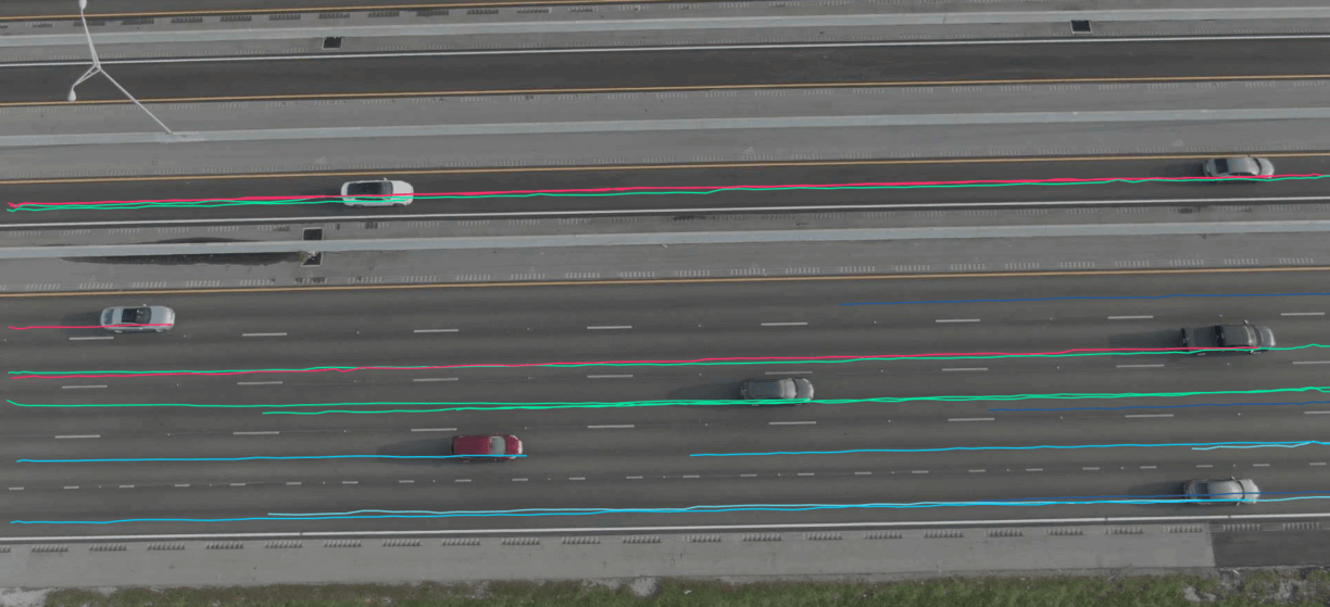
iPaaS provides the trajectory of objects recognized through images processed by the application. The trajectory provides a visual identification of the object movement, for example vehicles changing lanes, pedestrian paths, and clusters showing vehicle lane utilization. This trajectory data is provided visually and in a tabular format, containing coordinates of each object, allowing for further analysis when combined with other roadway characteristics data.